This is the only road in Canada that takes you across the Arctic Circle and into the land of the midnight sun. The Dempster leads you into a unique landscape, passing through territory that for millennia has only been changed by Mother Nature. Road construction took 20 years to get from Dawson to Inuvik, and after waiting almost 50 more years, the road to Tuktoyatuk, and the Arctic Ocean was officially opened in 2018.
Drive the Dempster as early in June as you can, which lets you get to Inuvik and Tuk right after the ferries open. You’re ahead of the tourist wave, and besides less traffic/dust along a 700km dirt road, almost all of the locals are excited to see the start of tourism season. Also, you don’t have to fight over Freedom Camping spots! (Don’t be a dick. Leave No Trace.)
The Highlights
Every night, we play a “Top 3” game where we pick our three favorite moments from the day. Well, here is your Dempster Highway Top 3.
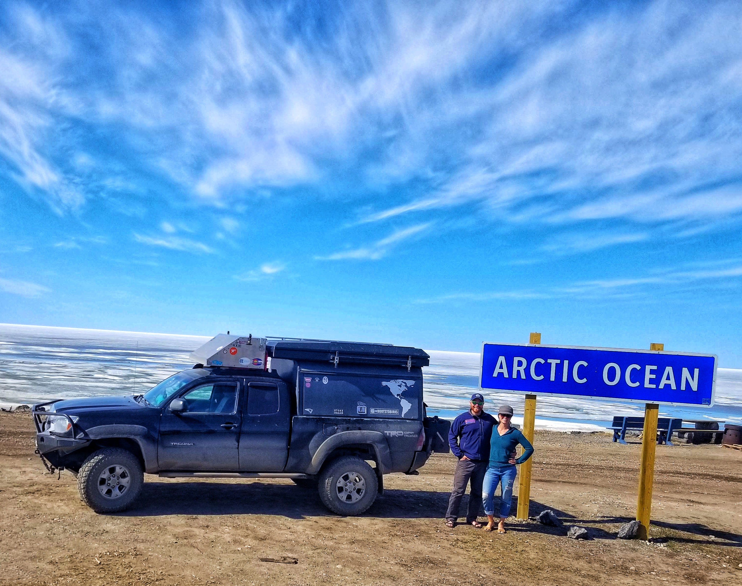
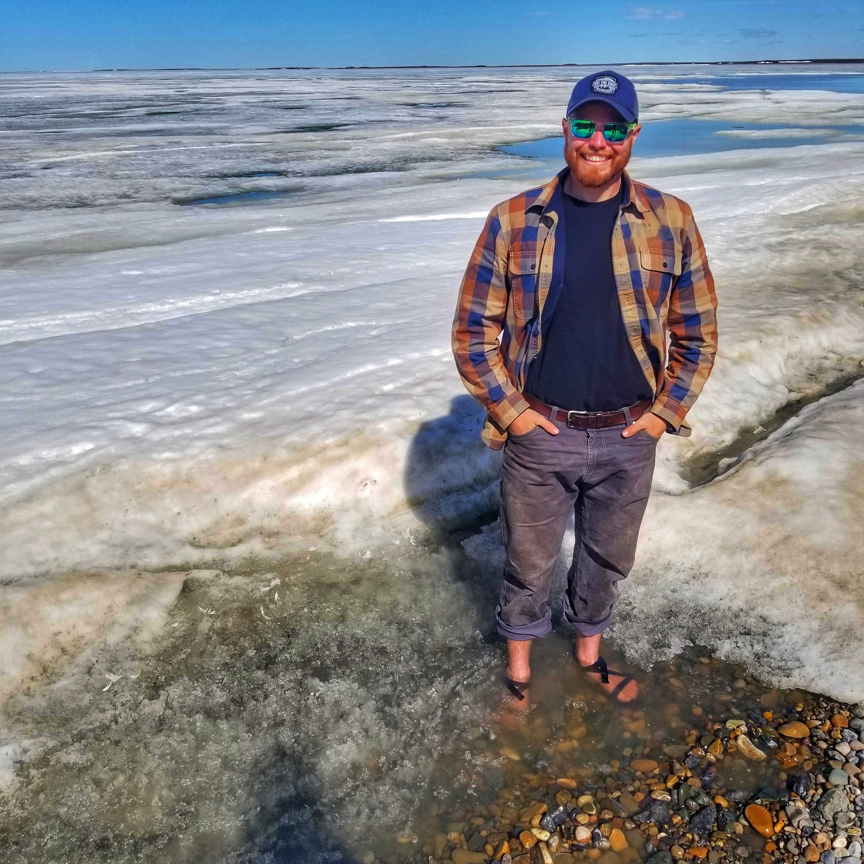
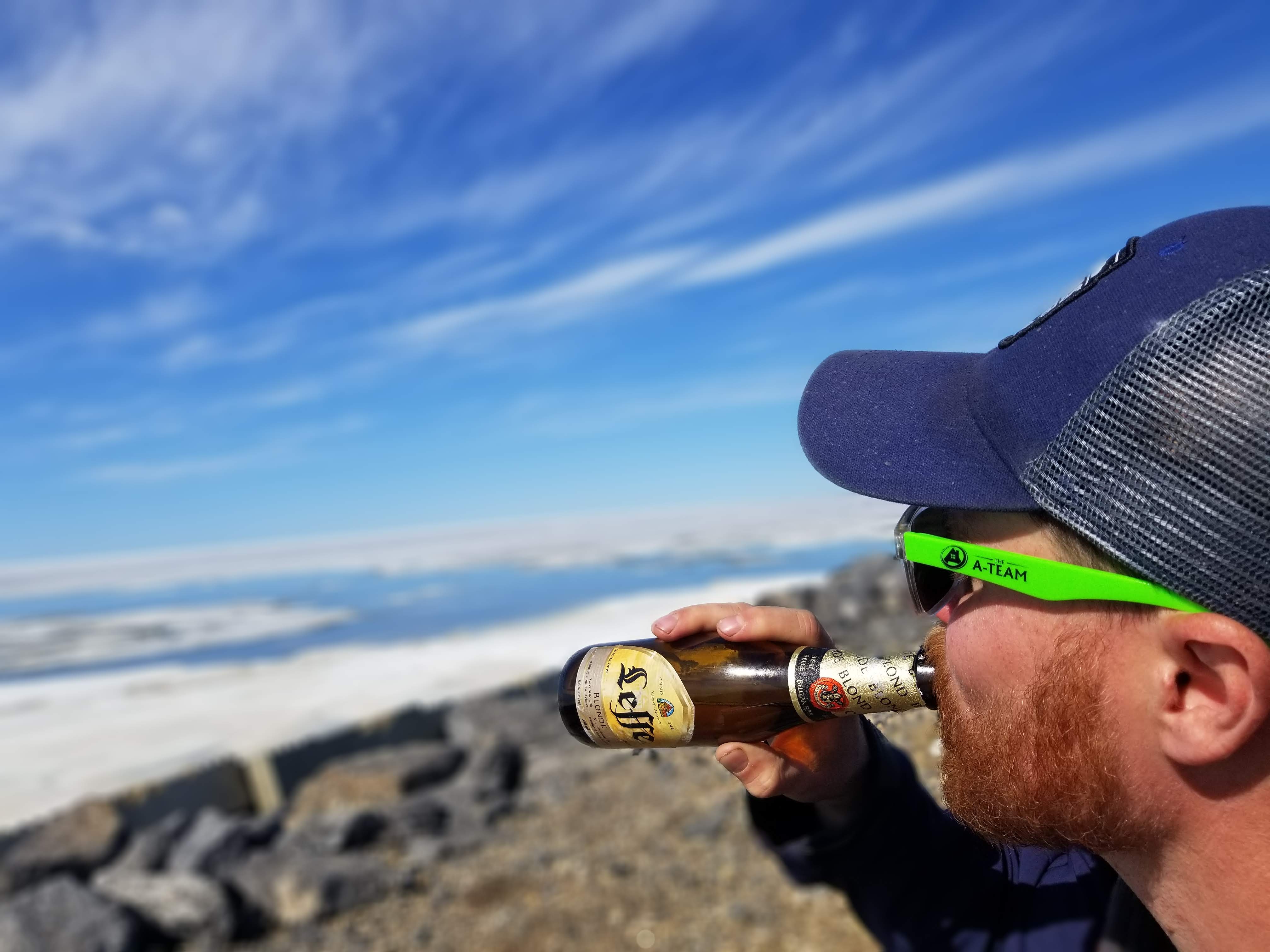
- The Arctic Ocean – Putting your feet in the Arctic Ocean is truly a bucket list opportunity. Swimming is frowned upon, as it’s a traditional fishing ground, or Clay would’ve dunked his head under too. We opted to share a beer at a picnic table at the end of the world, instead.
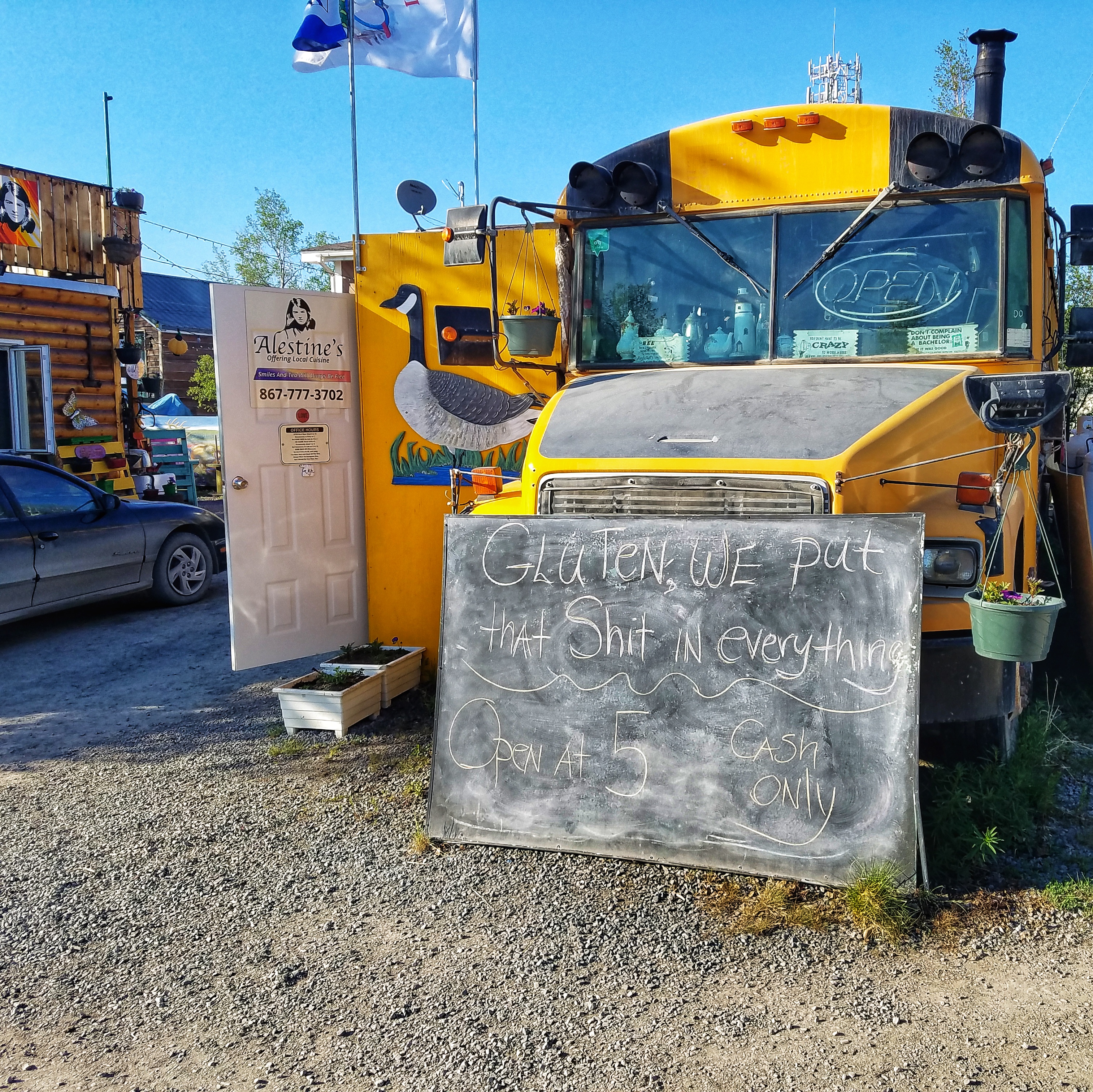
- Dinner at Alestine’s – Named after the Chef’s mom, Alestine’s is a unique school bus food truck parked next to an “earthy” beer garden. The food is fresh and delicious but prone to running out. The owners are possibly some of the nicest people we’ve met on our journey so far, considering they whipped up a pair of fish tacos for us after running out of food for the evening.
- Inuvialuit Day Celebration – We hustled to make it to Inuvik by June 5th for the 35th Anniversary celebration of the Inuvialuit Land Agreement. Consider it as close as you can be to an Independence Day celebration for the local community. We were able to watch traditional dancing, athletic games, listen to stories from the elders, and try eating Beluga Whale, Muskox, and Reindeer!
Click any image in the galleries to open full size!
The Stops
Not many “stops” along the Dempster. That’s what makes it so special!
• Tombstone Territorial Park Visitor Center – What an awesome park headquarters in the middle of “nowhere”! Super helpful staff and it’s where you can grab a copy of the local highway guide, which goes into much more detail than the Milepost. We had the benefit of being on the leading edge of the tourism tidal wave, so the staff was excited to have their second vehicle of the day when we pulled in a little after 2pm.
• Eagle Plains Hotel/Gas – This is your chance to gas up at the “halfway” point between the start of the highway and Inuvik. That’s about all that you want to do in Eagle Plains unless you’re into overpriced beers and frozen food. Maybe I just have a bad taste in my mouth because someone stole 2 shackles off our truck in the 30 minutes we were there!
• Fort McPherson – The only other stop between Inuvik and Dawson, McPherson is a quaint, friendly, Gwich’in community located on the Peel River. The town is situated between two ferries on either side, so the whole area is a welcome stimulus change from the rolling and bumpy Eagle Plains Plateau. We drove around town and cooked breakfast at the visitor center across from the Community Gardens. If it weren’t for wanting to make the next ferry, we would have stayed and helped them plant kale and spinach in the greenhouse!
The Drive
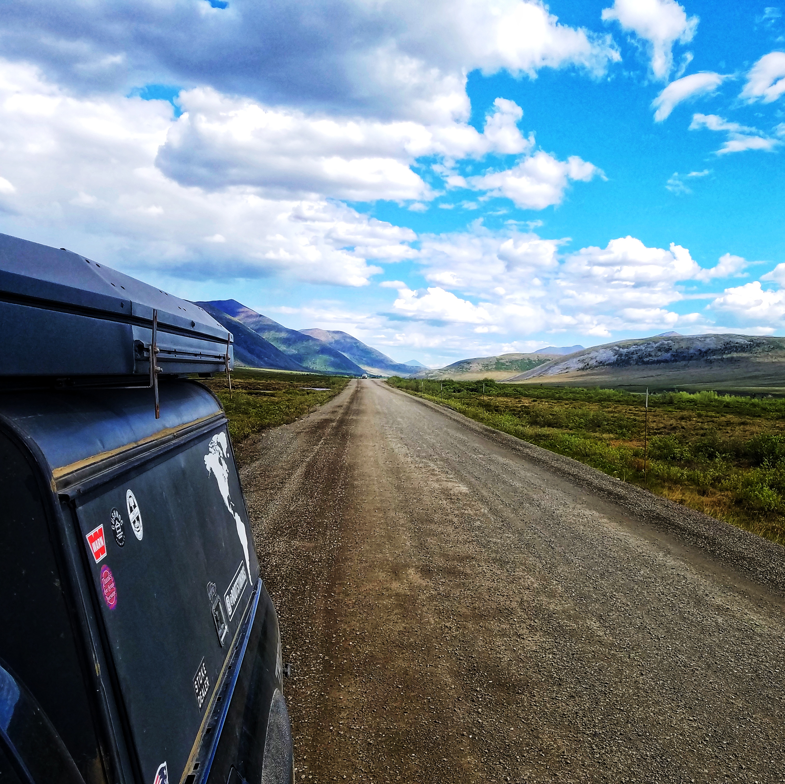
If you don’t like driving, then I wouldn’t suggest taking the 1800km, 4+ day, round trip from Dawson City to Tuktoyatuk. On the other hand, if you look forward to driving 50mph/80kph on winding and rolling dirt roads without seeing another vehicle for an hour or more, then the Dempster is for you.
There are plenty of tourist guidebooks that will give you play-by-play, interesting facts, and more history than I can fit into a 1,500-word blog post. So, what do most travelers need to know?
• You can drive it in your RV. If you only have a passenger car, the 700km road might be a little tough on smaller car/SUV tires. Drive at 50mph/80kph and save some wear and tear on your vehicle. Also, bring a full-size spare, fix-a-flat, and ALL the tools to change a tire. (We helped a Kiwi couple hammer a flat off their van because it was rusted tight to the brake drum)
• Don’t rely too much on other people’s “road reports.” The highway crews are doing work on the highway regularly so someone’s rough section might be your smooth sections.
• Gas is going to be about $0.10/L more expensive in Inuvik than Dawson. Your fuel mileage is going to decrease with the loose gravel roads, too.
• The dust is no joke. Be prepared to wipe everything down at the end of the day and wash your hands every chance you get.
• If you thought the dust was bad, wait until you meet the mosquitos. Yes, they are the size of small hummingbirds. But, at least they will make a great “war story” to tell everyone else who didn’t go north!
• Plan on at least 2 days of driving each way and another day to get to Tuk. Yes, you can do it in a day, but… why?
The “Must Do’s”
• Igloo Church – The Catholic Church in Inuvik is anything but a typical church. Built by a Frenchman with a 5th-grade education, a Priest who could speak the local language, and a handful of volunteers, it’s a marvel in redneck engineering. They built it with everything from scrap aluminum shingles to stairs made from hockey sticks. Not to mention only having one “architectural drawing” penciled on a sheet of painted plywood.
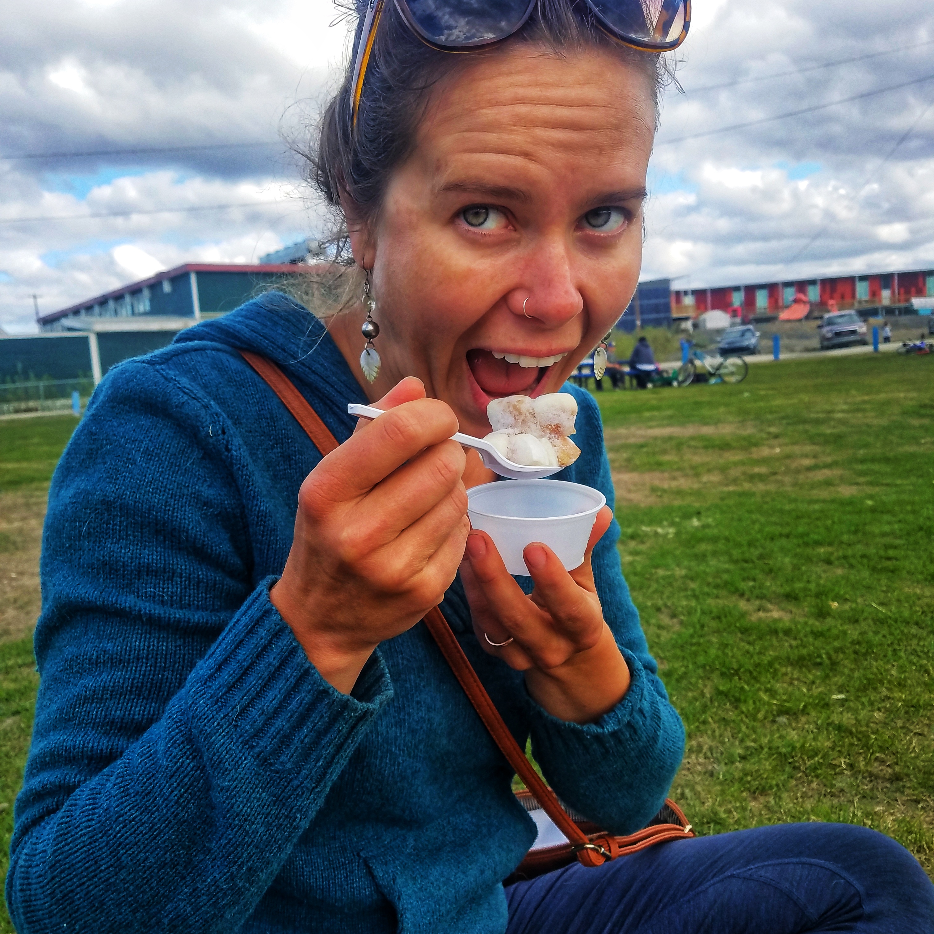
• Granny’s Kitchen – $10 for 6 bite-sized pieces of Beluga Whale, might seem a little steep, but then again, when else do you get to eat whale from a food truck…? Follow the handmade signs in Tuk and eat your Muktuk Bites and Muskox Burkers.
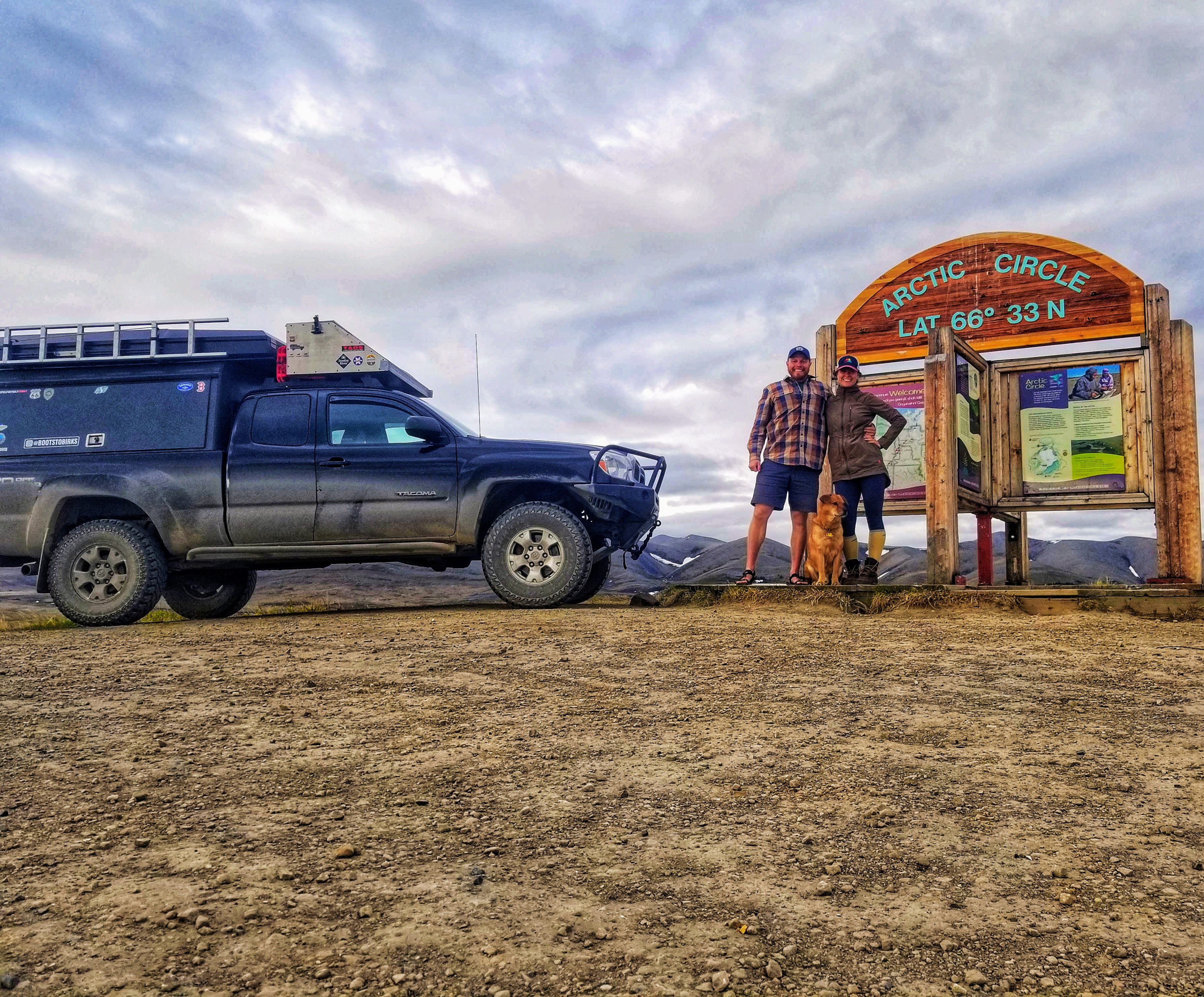
• Arctic Circle – There are only a handful of roads that cross the Arctic Circle in North America. Stop for a photo at the sign marking the furthest south point that the sun never sets on June 21st and never makes it over the horizon on December 21st.
• Talking with the locals – What a cliché tourism thing to write. Regardless, we had some incredible conversations with the local Inuvialuit people, especially some that were 10-20 years older than us. Extremely welcoming and friendly, they wanted to hear our story just as much as we wanted to listen to theirs.

The Hikes
Of the 4 hikes recommended to us at the Interpretive Center, all 4 are 100% worth doing. If we had to prioritize, this is the order we would do them in:
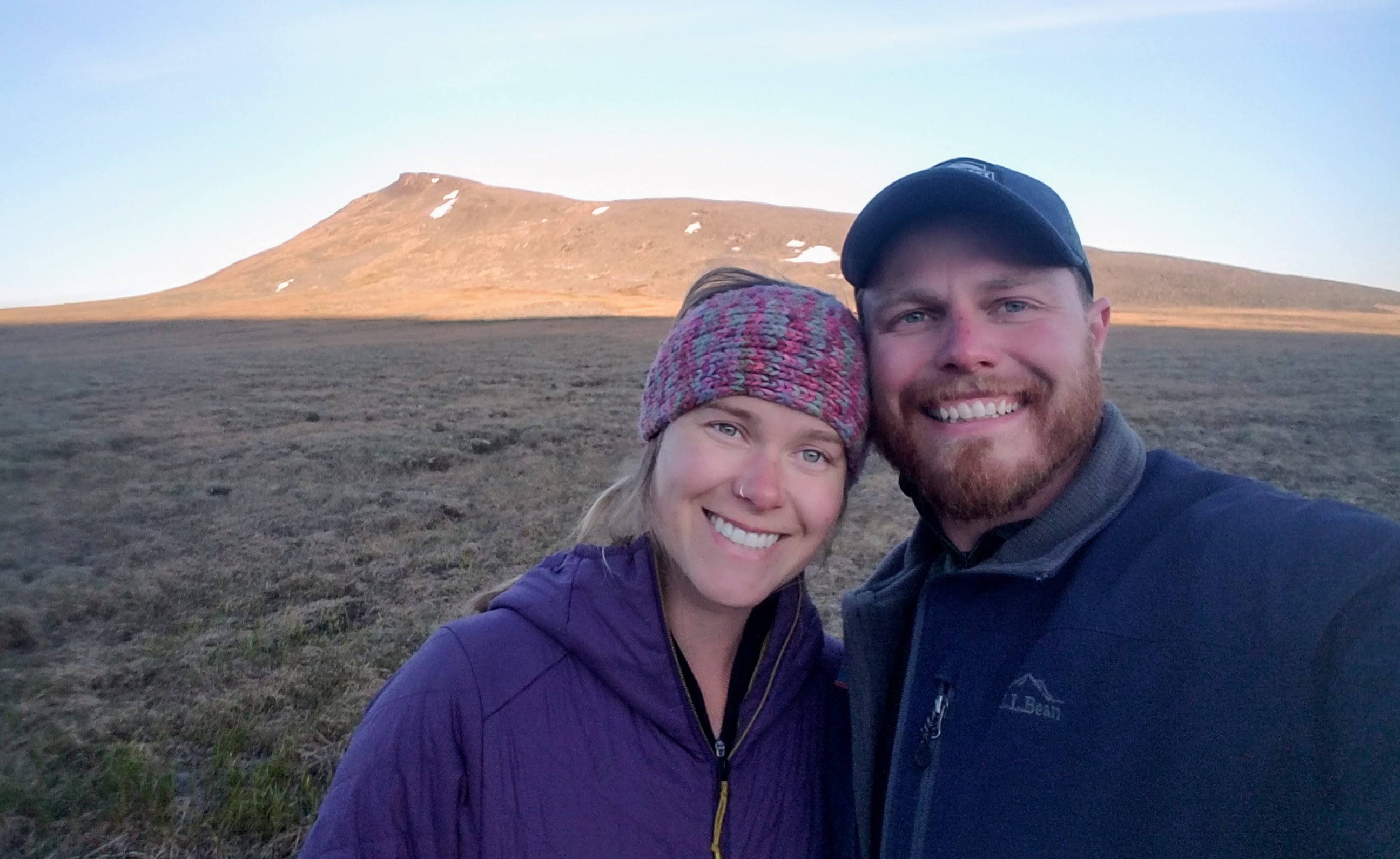
• NWT/YT Border Midnight Hike – Go east from the border pullout. There’s no hiking trail, but try to stay on the rocks and off the moss as much as you can. You’re rewarded with amazing views of the arctic tundra and Richardson Mountains at the top. A 100km north of the Arctic Circle, we started this hike at 12:07am and finished at 1:45am, which made it extra special never to see the sun go below the horizon.
• Sapper Hill – Park on the north side of the Engineer Creek Bridge and the trailhead is in a little gravel turnout to the east. 1.5hr round trip hike to some really cool “tors” or granite spires stabbing out of the ridgeline like giant knives.
• Grizzly Creek – Close enough from Dawson for a day hike, this well-trodden hiking trail isn’t quite a “backcountry experience,” but it’s a good workout and a killer view for just a 3 hour round trip. You really see the magnitude of the Tombstone Mountains and why they are called the “Patagonia of the North.”
• Taiga Range – Don’t worry about a map, you can make a 10km ridgeline loop and see the parking lot the entire way. The route is almost entirely above tree line with endless 360-degree views. If you’ve never hiked in open bowls, it’s totally worth it.

Great description, guys. Sounds unbelievably rugged and foreign, even if it’s right here in North America. I drove a similar road in Chile a few years ago with my son, and we loved camping out and just trying to find a place to buy food and gas. Loved every minute of it.
All the best.
Thanks Steve! It really was otherworldly up there and totally worth the drive.