Leaving the Green Mountains of Vermont was one of the more bittersweet moments we had on the northern part of the Appalachian Trail. Lindsay and I both looked forward to tackling the looming challenge of the White Mountains partly because of the beauty that the big peaks and ridge lines of New Hampshire held on a clear, sunny day but also so that people would stop talking about how hard they were going to be. It seemed like “The Whites” produced a near-paralyzing fear for at least 100 miles before the first climb. Considering the fact that a blind man (Bill Irwin) had thru-hiked and people in the 80s thru-hike every year we assumed that some of the anxiety might have been from slightly exaggerated stories and tales. Nonetheless, we decided to err on the side of caution and take a rest day to load up on calories and resupply our food in the beautiful New England town of Hanover, NH. As long as erring on the side of caution is having a self-cooked pizza feast at the community pizza ovens with a case or two of Long Trail Ale then we were very safe in our preparation for embarking on our White Mountain Adventure.
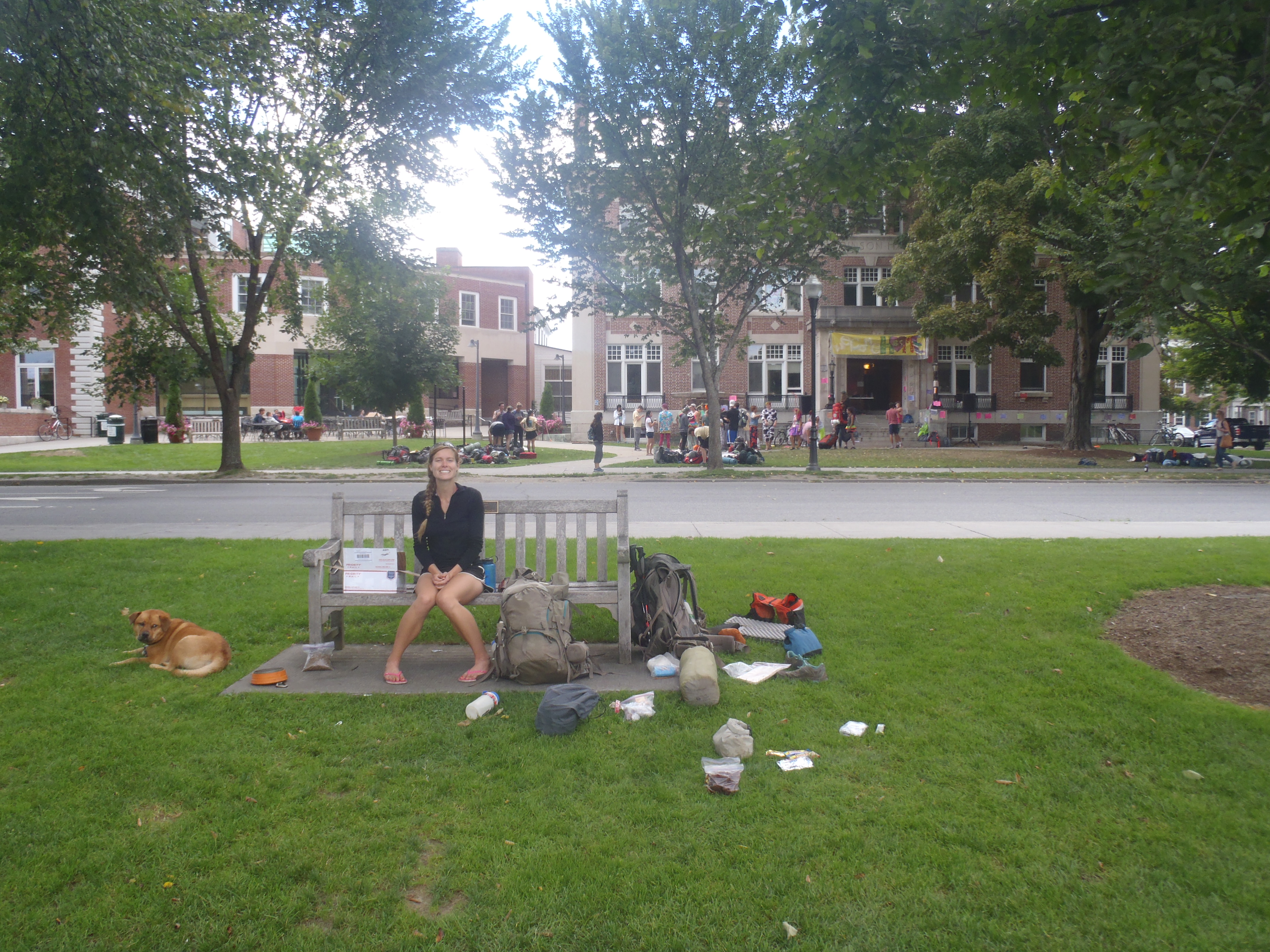
Lindsay and Hunter enjoying our half-day in Hanover, NH on the green of Dartmouth College

Cooking pizza in Hanover, NH
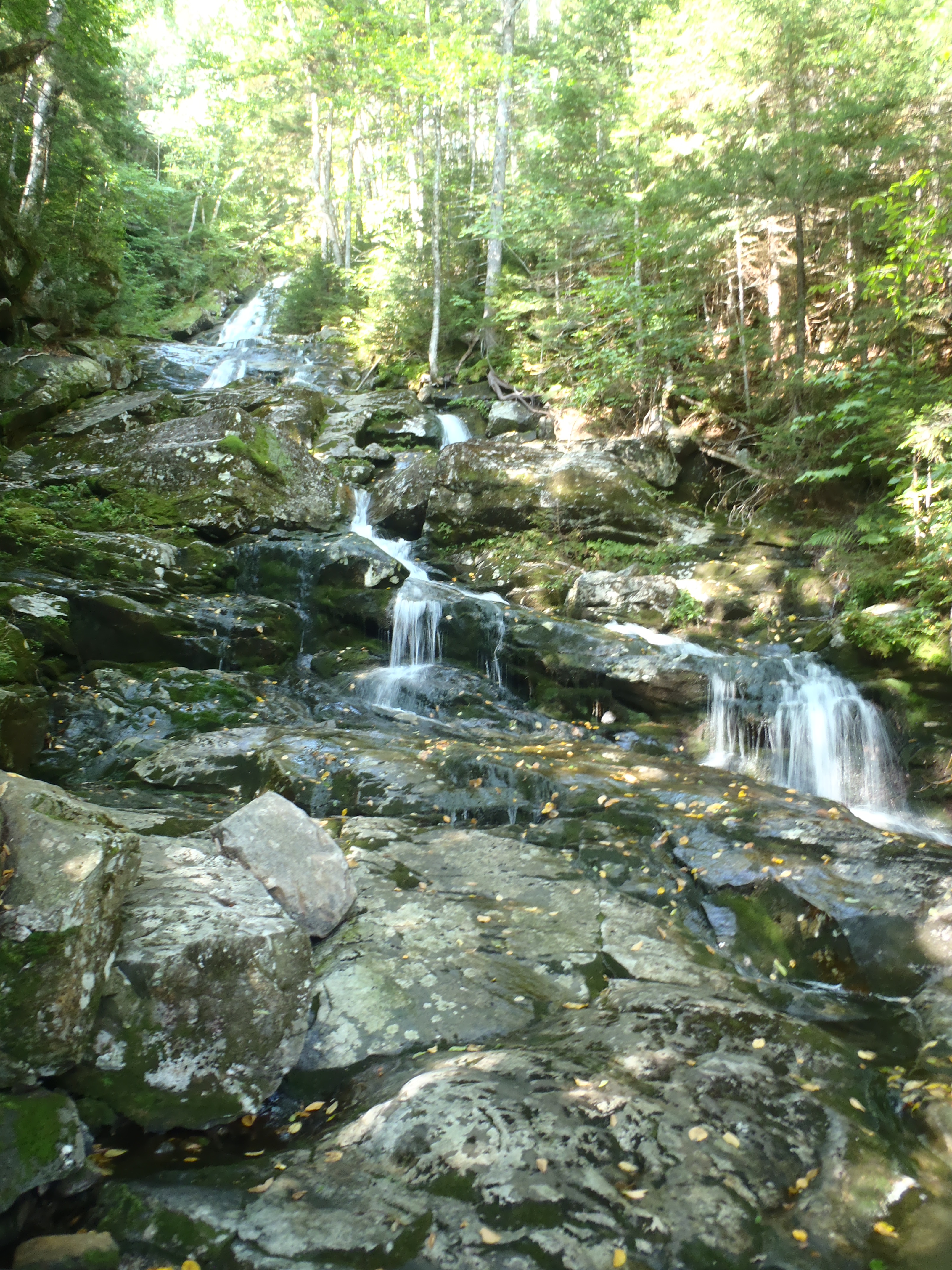
Waterfall and lunch break location on the north side of Mt Moosilauke

Clay on the PAINFUL and SLIPPERY , 3 hour descent of Moosilauke.
With no extra dog food in our packs to slow us down we forged on northeast towards Mt Katahdin with the pesky little White Mountains standing in our way. Well, let me be the first to say that Mt. Moosilauke at 5,200ft and the southern most peak in The Whites was quite pesky but not very little. Welcome to the big mountains, Fat Kids! After walking an average of 2.5mph for the first 1700 miles of our trip and slowing down to 2mph in any mountainous areas, taking two hours to descend the final mile of Moosilauke was a big surprise to say the least. The Whites might be beautiful, but they are also quite slow walking. The first two days, ascending and descending both Mt Moosilauke and Mt Kinsman, are the hardest but also slowest days on the New Hampshire Appalachian Trail. The day we went over Mt Kinsman we walked for 12+ hours, literally sun up to sun down, and barely covered 14 miles. After two days and only two mountains, hiking an hour in the dark to find a campsite, and a half-dollar size chunk of skin missing from my wrist after sliding down Kinsman we both had the realization of “if it’s like this for another 100 miles we are going to have our butt’s kicked!”
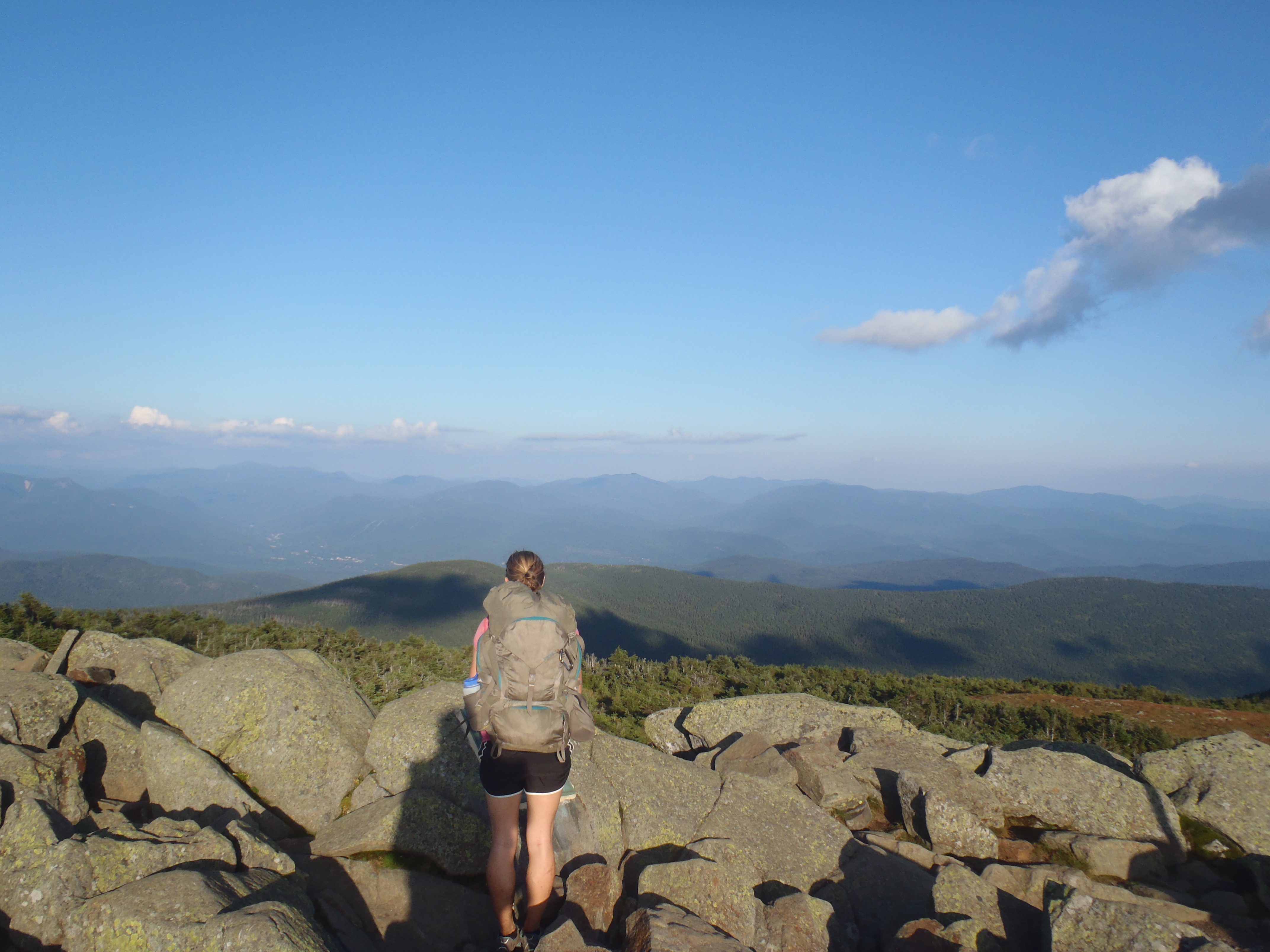
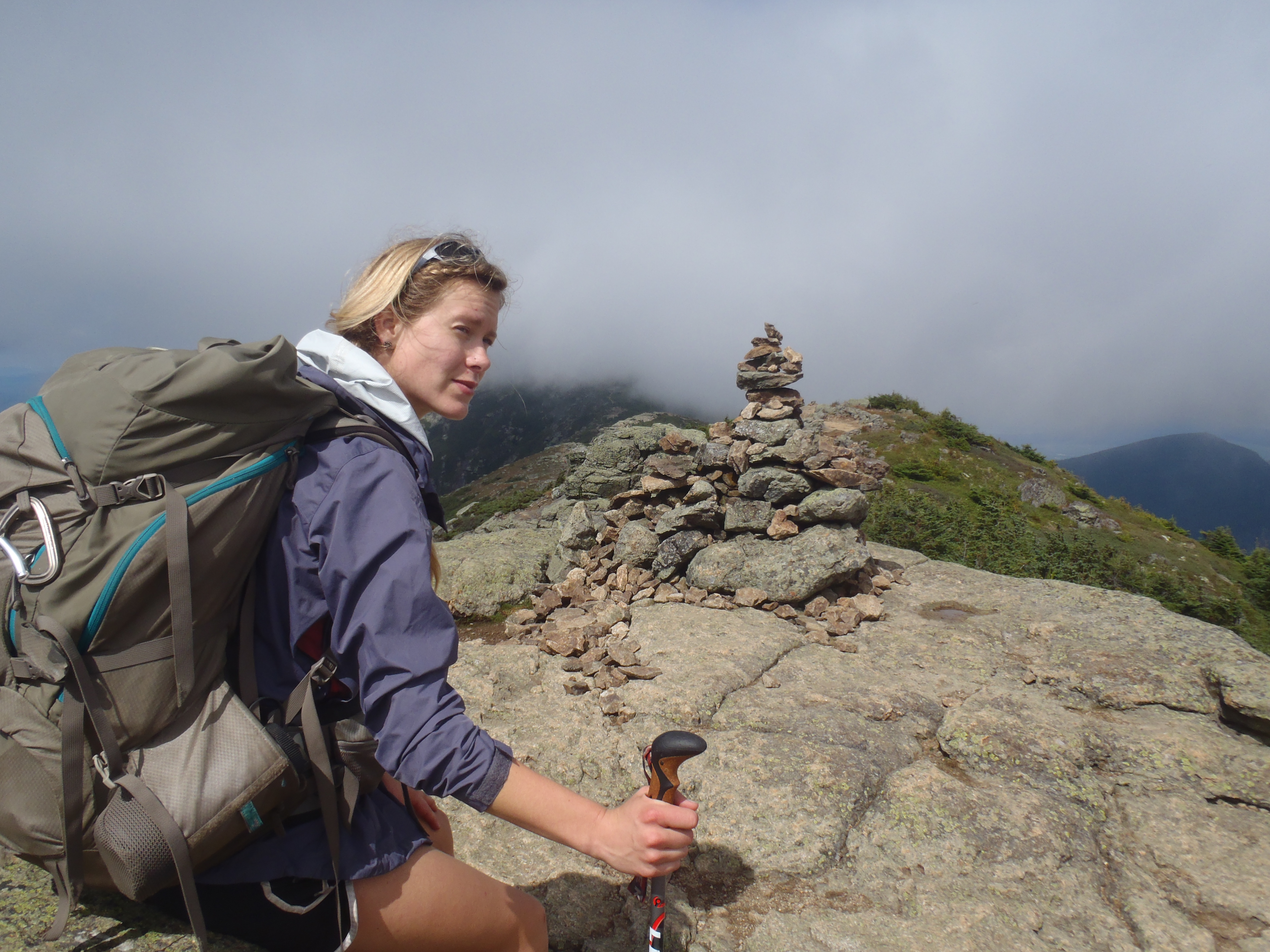
Lindsay looking north from one of the two Kinsman peaks
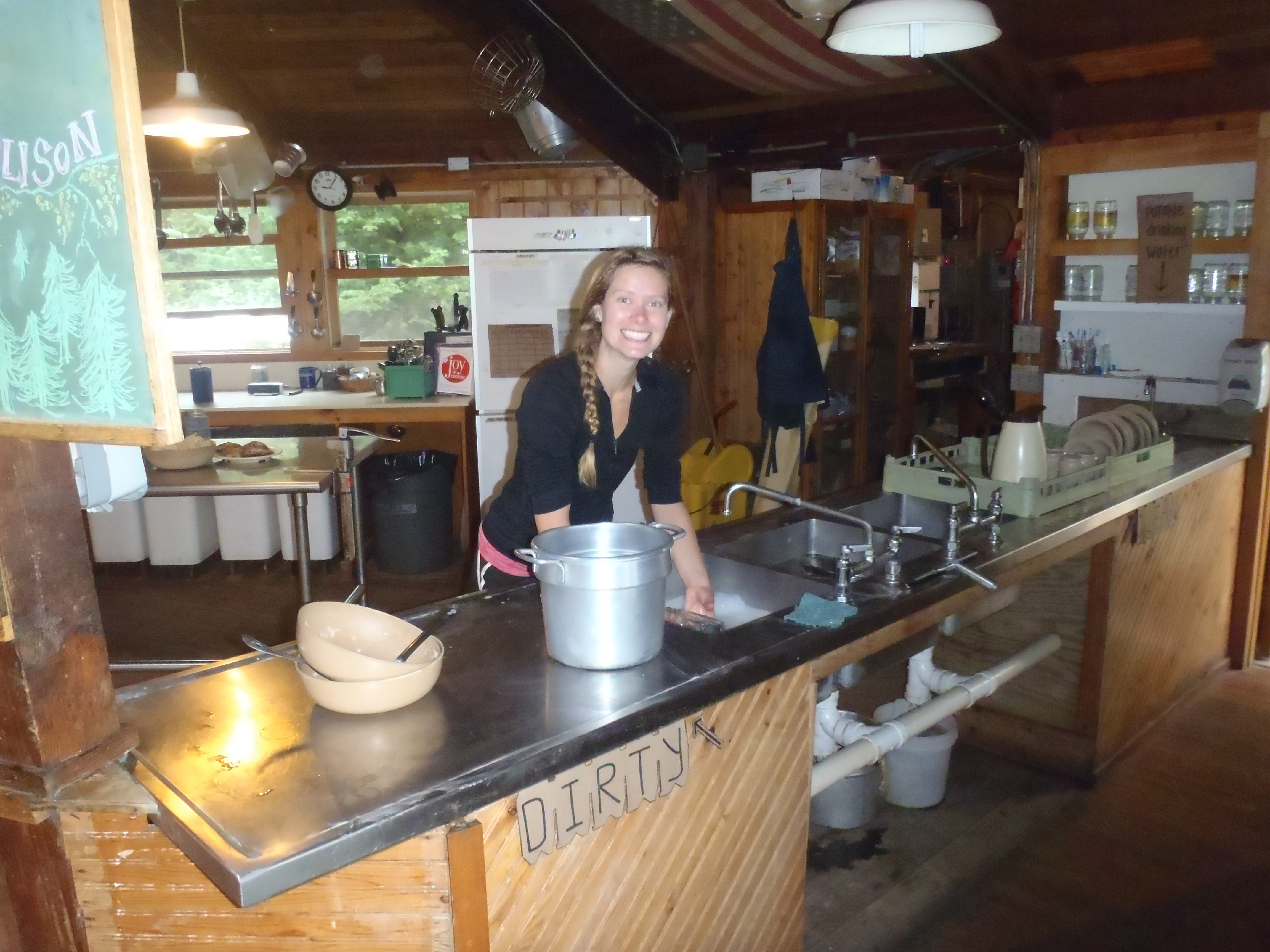
Lindsay doing some dishes on a work-for-food while Clay takes photos!
As things tend to work out on the trail, you seem to run into long lost friends right at your point of lowest morale. We spent the night at the bottom of Kinsman in our tent, riding out one of the most intense thunder storms we had experienced in months just hoping and praying a tree didn’t fall on us (again) and we could stay dry until morning. The next day we stopped at an Appalachian Mountain Club (AMC) Hut, where vacationing hikers can spend $100+ /night for a bunk, dinner and breakfast, to get a bandage for my wrist and fill our water bottles and stumbled upon Fern Gully and Sunshine sweeping the floor! Well, as it turns out the AMC has a work/food-for-stay program designed to help AT thru hikers at all of their huts, and our friends took advantage of it the night we spent trying not to drown in our tent! The availability and type of work is normally up to the Hut Croo (staff) but more often than not the first couple hikers who stop in after 5pm can sweep some floors, clean some bathrooms and do the dishes in exchange for a floor to sleep on and leftovers from both dinner and breakfast. The AMC has seven evenly spaced huts on the AT and even if we didn’t plan on staying there we still tried to get some food from them! In all honesty, stopping in at 10am and offering to do dishes and sweep a floor in exchange for any of the leftovers in the fridge isn’t too bad of an idea! Our tight schedule, pushing an average of 15 miles/day kept us from spending the night at any of the huts, but the ability to do work for food at almost every hut is honestly what kept me going through The Whites without chewing on tree bark for extra calories.

Lindsay, Fern Gully and Sunshine on the Franconia Ridge
Lindsay heading into the unknown of the Franconia Ridge with Mt Lafayette in the clouds

Fern Gully and Lindsay enjoying a trail magic brew in the Franconia Notch
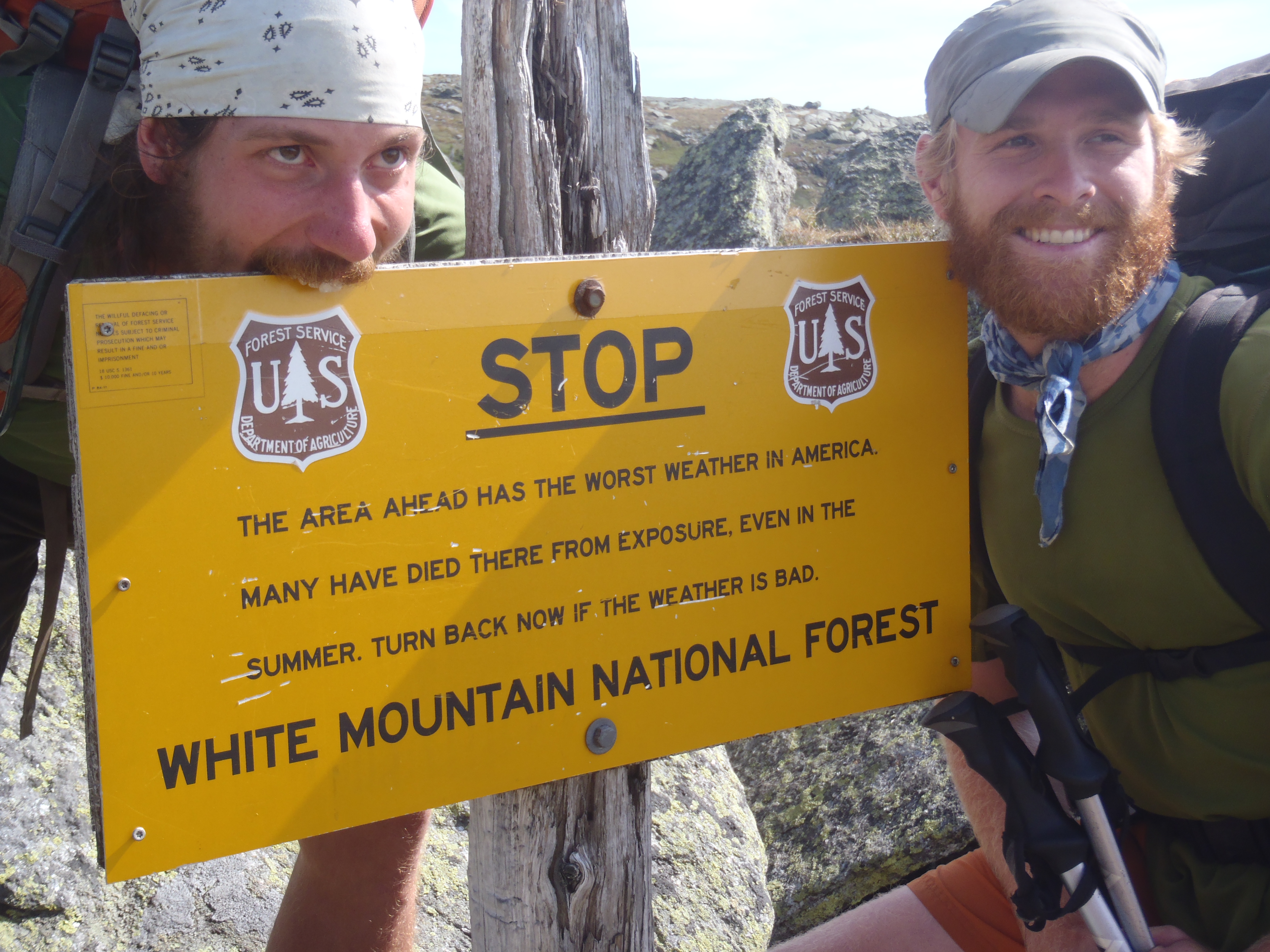
One of the most stressful or beautiful days on the Appalachian Trail occurs in The Whites and is entirely weather dependent. The climax of The Presidential Range is summiting Mt Washington, which is also home to the worst weather on the planet. Knowing that thunderstorms with 50mph(+) winds and accompanying rain were forecasted in the near future, we decided to “sprint through” the Presidential Range. Granted it is 12 miles, 10,000ft total vertical change and some of the more difficult hiking on the entire trail to get from Crawford Notch to the summit of Mt Washington, the term “sprint” needs to be used relatively. Nonetheless, we hit the top by 3pm and met 150 of our closest friends who drove to the top on the beautifully calm and cloudless day the preceded the storm front we could visibly see moving in on us. The dichotomy of thru hikers who had worked for four, or more, months to reach that point at the top After standing in a line of tourists for 20 minutes, after walking 1750 miles from Georgia, to get our picture on the highest peak in New England the time came to make a weather call and scoot down to safety. The Appalachian Trail continues along a ridgeline above tree line for another eight miles to Mt Madison before descending to lower elevation with the first possible camping sites a full 12 miles from the summit of Washington. Being late in the day and knowing that thunderstorms sat on the horizon we decided to make a weather call and take a direct 4 mile descent down the mountain on a ‘bad weather’ alternate trail. Did we wimp out and “skip” 12 miles of white blaze trail? Yes. Was it the right call because flirting with weather in the White Mountains is a terrible idea? Yes. That’s why they say hike your own hike!
Fern Gully and Sunshine pose on the ascent of Mt Washington… I swear the hike hasn’t made us go crazy!
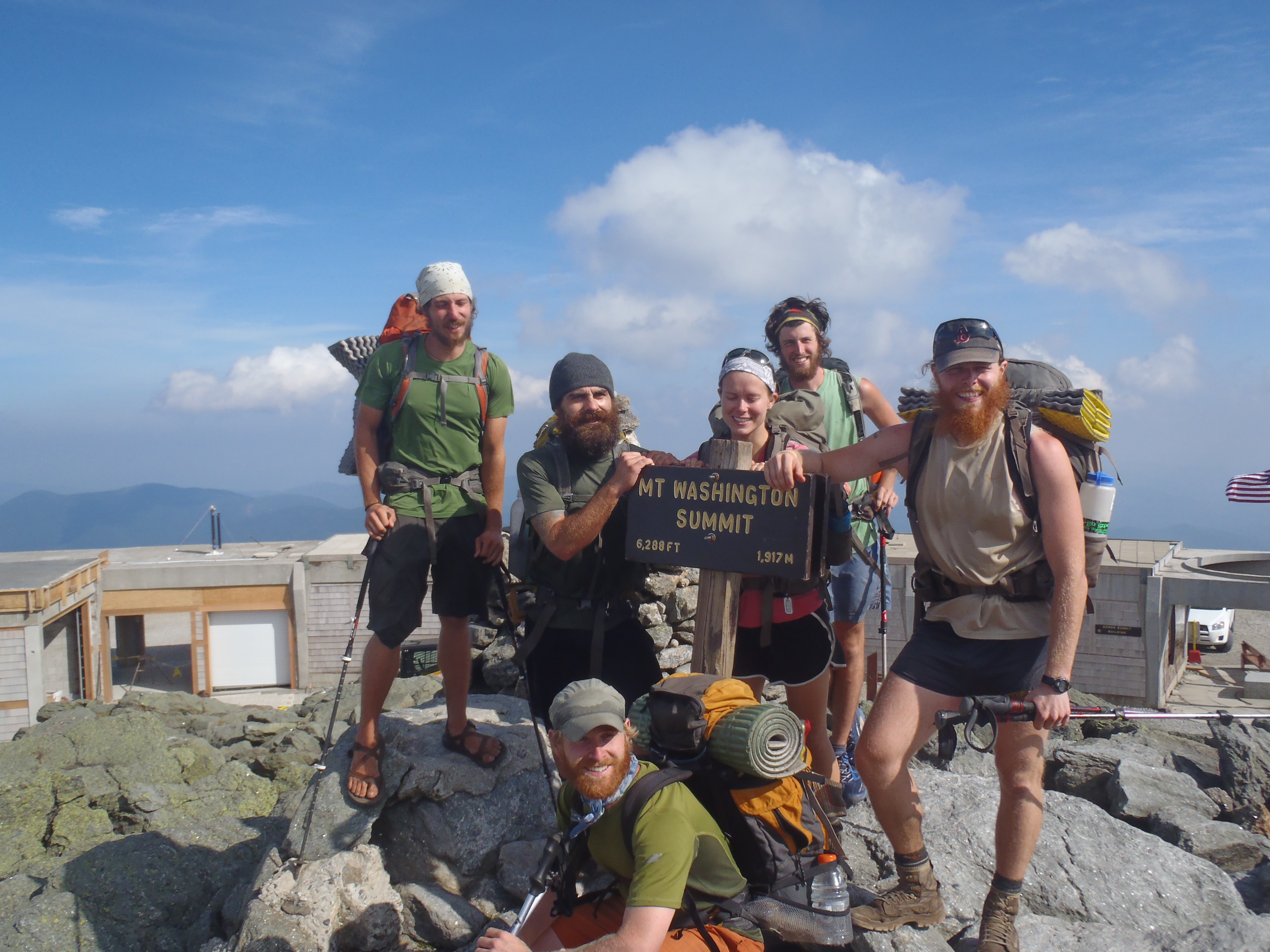
The Crew at the top of Mt Washington
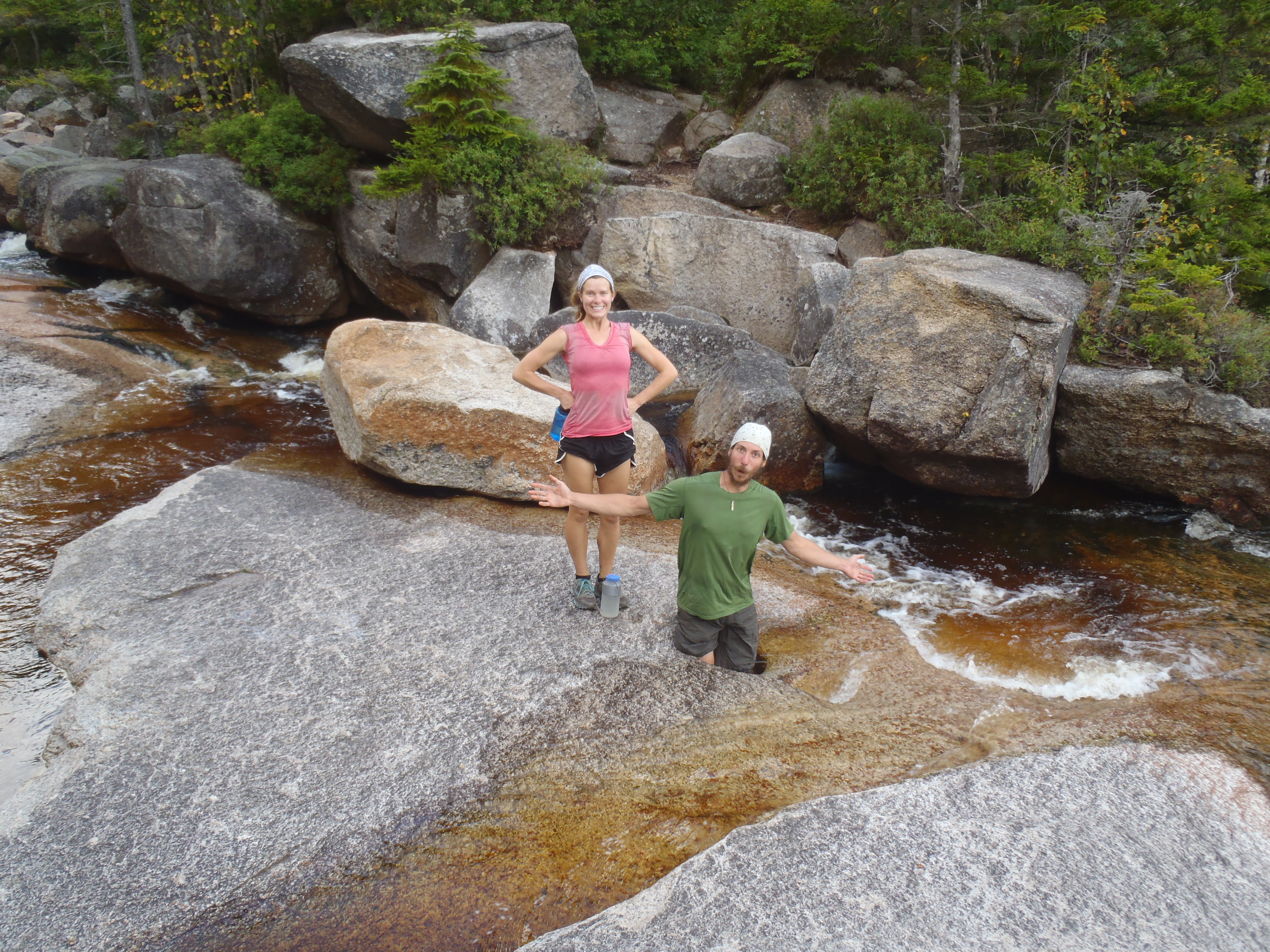
Fern Gully and Lindsay playing in one of the hidden waterfall areas of The Whites
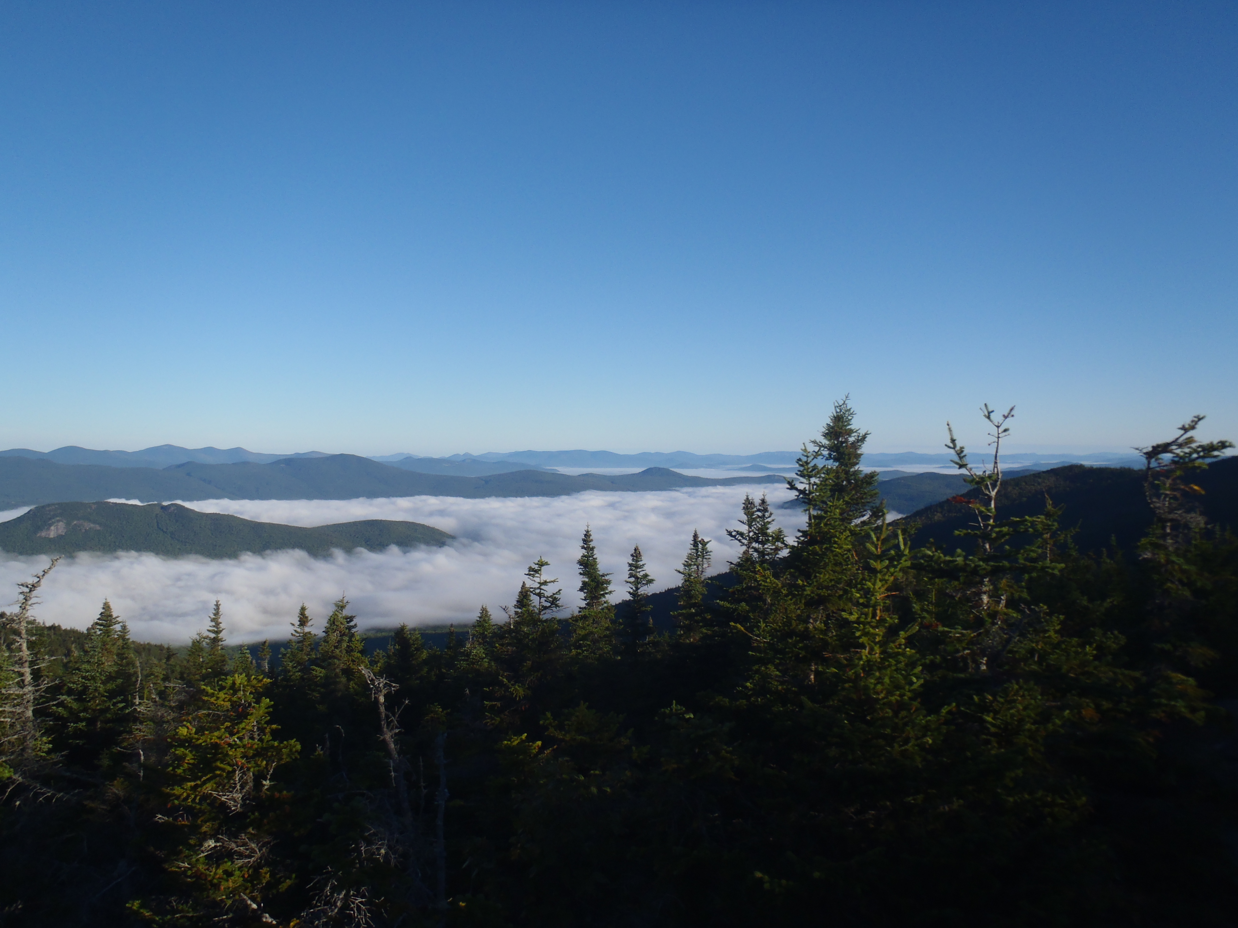
The view on our final morning in the White Mountains from the top of Carter Mountain
